
Camping trips took a while to grow on me. Decades, really. As a kid I spent a night or two camping with my fellow Cub Scouts (where the highlight was filling my least favorite scout’s sleeping bag with frogs before he climbed in), but otherwise I was more of a stay-indoors-playing-Dungeons-and-Dragons type. Several years after college my outdoorsier buddy David took me on my first multi-night backpacking trip, an easy hike in Colorado, and I found myself restless, counting the hours until we could return to civilization. Being away from computer screens and Diet Coke made me antsy.
Gradually I came around. In my early 30s I joined a week-long kayaking trip in southeastern Alaska with my buddy Phil, his brother-in-law, and a friend of Phil’s family who used to be a park ranger in the area, and it was an incredible experience.

Around that same time I started getting particularly interested in U.S. National Parks, eventually visiting them all. On my around-the-world trip in 2010-11 I spent a lot of time outdoors, with a week of trekking in Nepal, a five-day climb of Kilimanjaro in Tanzania, hikes in Torres del Paine National Park in Chile, and a two-day climb of Cotopaxi in Ecuador. In recent years Marie and I tackled the Inca Trail, hiked down to Havasupai (twice), and camped in places like Rocky Mountain National Park, Yellowstone, Yosemite, Zion, White Sands and the Bisti Badlands, the Ansel Adams Wilderness, and Mongolia. Last year I did a three-day hike along California’s Lost Coast with a couple of friends.
But until now I’d never done a multi-night backcountry trip by myself. A global pandemic is mostly terrible, of course, but it turned out to be a good excuse for me to pull the trigger on a High Sierra trip I’ve been eyeing for years: the 42-mile Rae Lakes Loop in Kings Canyon National Park. Admittedly the prospect of hiking that far with a heavy pack and 7,000 feet of elevation gain was a little daunting. Recently I did a much shorter hike – eight measly miles roundtrip to Upper Cathedral Lake in Yosemite, over two days – and even that left me worn out and sore.
I didn’t want the trip to be solo. Marie opted out for a variety of reasons, including work and a propensity for altitude sickness. My friends Phil and Lawrence claimed to be tempted but ultimately passed. Marie’s teenage son Aidan considered joining me, surprisingly, but for some reason decided it would be more fun to stay at home playing video games, hanging out with his friends, and not hiking 42 miles. So I was on my own.
From what I read, most people do the Rae Lakes Loop in four days, averaging a little over 10 miles a day. I decided to give myself five days. I might need that much time just to cover the distance, I thought, and I also wanted to have the flexibility to wait around for good photo conditions along the most scenic part of the trail.
As the day of my trip approached so did a creeping sense of trepidation. What if my left knee, which has been bothering me on stairs lately, just gives out? What if I mess up my back? What if I get bored? I struggled with the very real possibility that my level of fitness – both physical and psychological – wouldn’t be up to the task. I began to wish the first day of the hike would arrive so I could just get it over with.
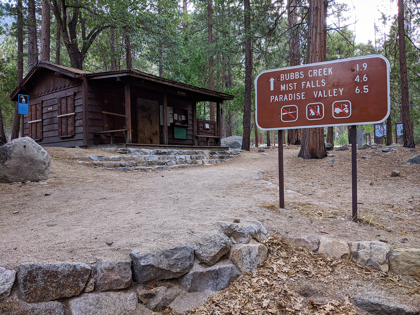
Finally it was time to head out and on a Sunday afternoon I drove four hours from Marie’s place in Mountain View to Hume Lake, which had the closest open campground I could find to the Rae Lakes Loop trailhead. On the way I made a quick stop to see General Grant, supposedly the second-largest tree in the world. The next morning I woke up early, drove to the trailhead, fueled up with coffee and a quick breakfast, and a little after 8am took my first steps on the trail.

Day 1: Road’s End to Upper Paradise Valley (10 miles, 2,000 ft elevation gain)
The first couple of miles are relatively flat and easy before the trail cuts north along the South Fork of the Kings River and begins a long, often steep, uphill climb. I’d decided to hike the loop clockwise, which makes the altitude gain a little more gradual. The elevation of the trailhead is about 5,000 feet, and the highest point of the hike is just under 12,000 feet, at Glen Pass.

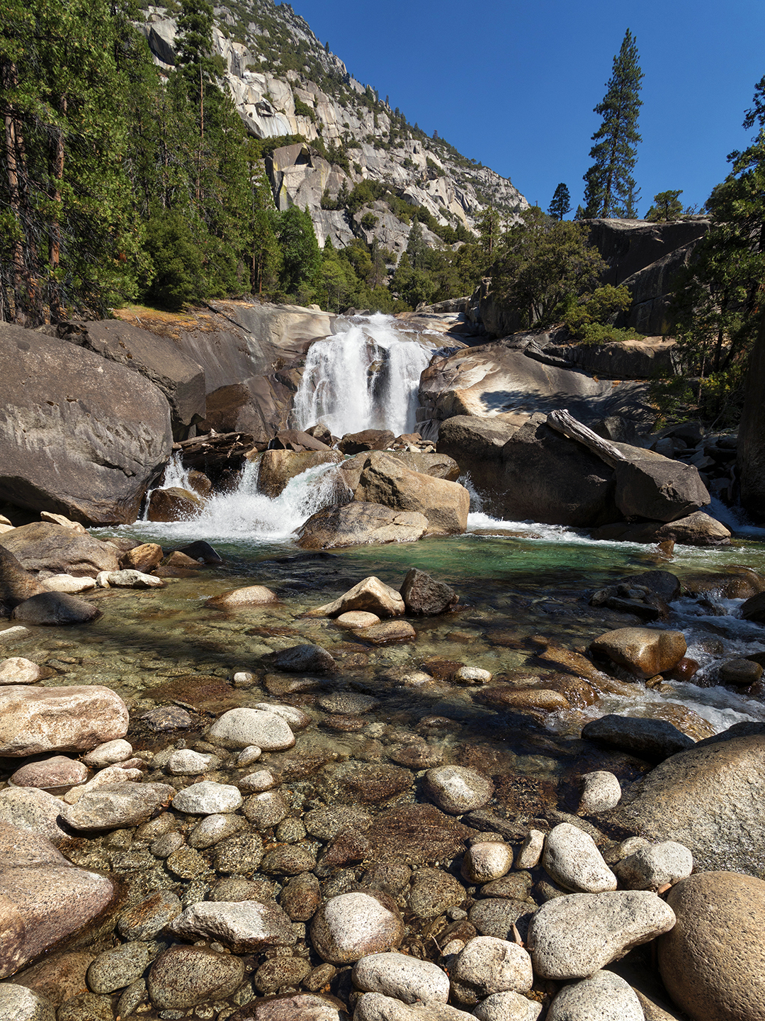
After a quick stop at Mist Falls I plodded slowly through a series of switchbacks before reaching Lower Paradise Valley. Many years ago I camped here for a night, just to check out Kings Canyon National Park, and during that trip I’d decided that someday I wanted to hike the full loop. It made me happy to finally be following through.


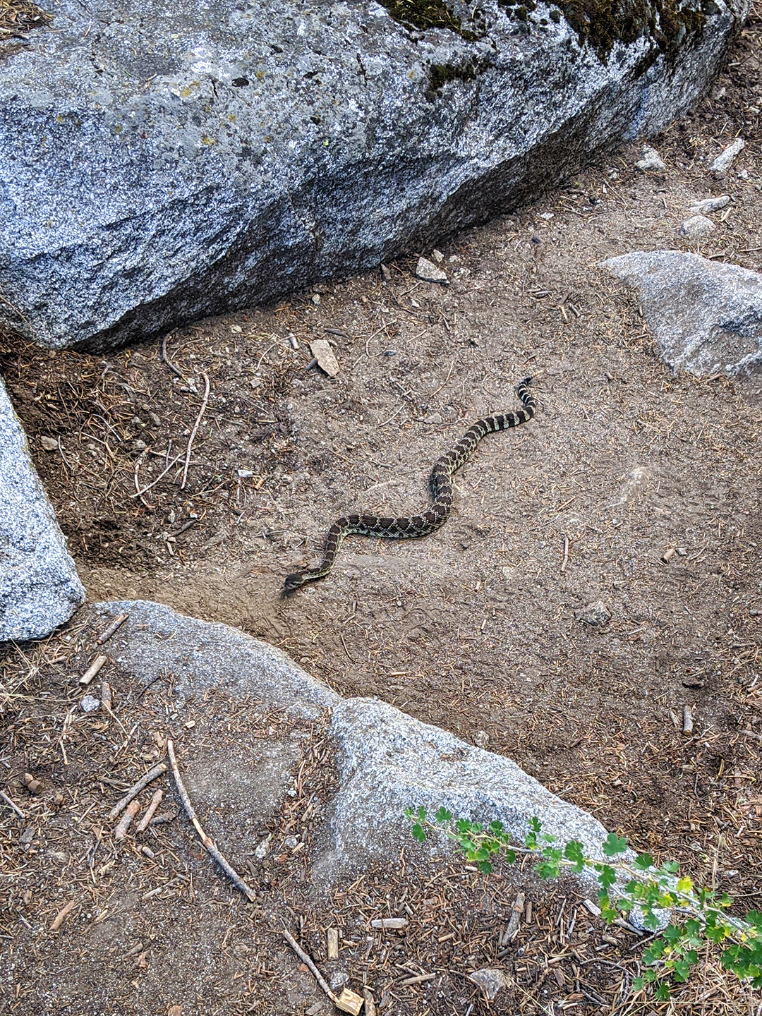
I sped up along a relatively flat section of the trail, my eyes tracking my boots, when a long dark shape appeared at the upper periphery of my vision, just a few feet ahead: rattlesnake! Seemingly unconcerned by my presence, the snake was in the middle of the trail slithering towards me. I conceded the right-of-way and gave it a wide berth, a chill running down my spine. From that point on I always kept a close watch on the trail ahead of me.
Four more relatively easy miles took me to Upper Paradise Valley, where I planned to stop and camp for the night. I arrived much earlier than expected. It was only 1:30 in the afternoon, leaving me with what felt like too much time to kill. The camping area was scenic enough, right next to a wide creek, but mosquitoes and other bugs were patrolling in force, making it unpleasant to be outside my tent. So I hid inside and read, predictably restless, and after a bland dinner of re-hydrated rice and chicken I went to sleep early.
Day 2: Upper Paradise Valley to Middle Rae Lake (11 miles, 3,100 ft elevation gain)
Expecting to be sore in the morning, I woke feeling so good that I wished I’d hiked further the day before. My legs were relatively fresh, my feet appeared to be blister-free, and my back seemed fine. The hiking I’d done the week before, as modest as it was, must have helped take the edge off my acclimation to trudging uphill with a heavy pack. I boiled water for my breakfast of dehydrated eggs and coffee, packed up camp, and hit the trail a little after 7am.
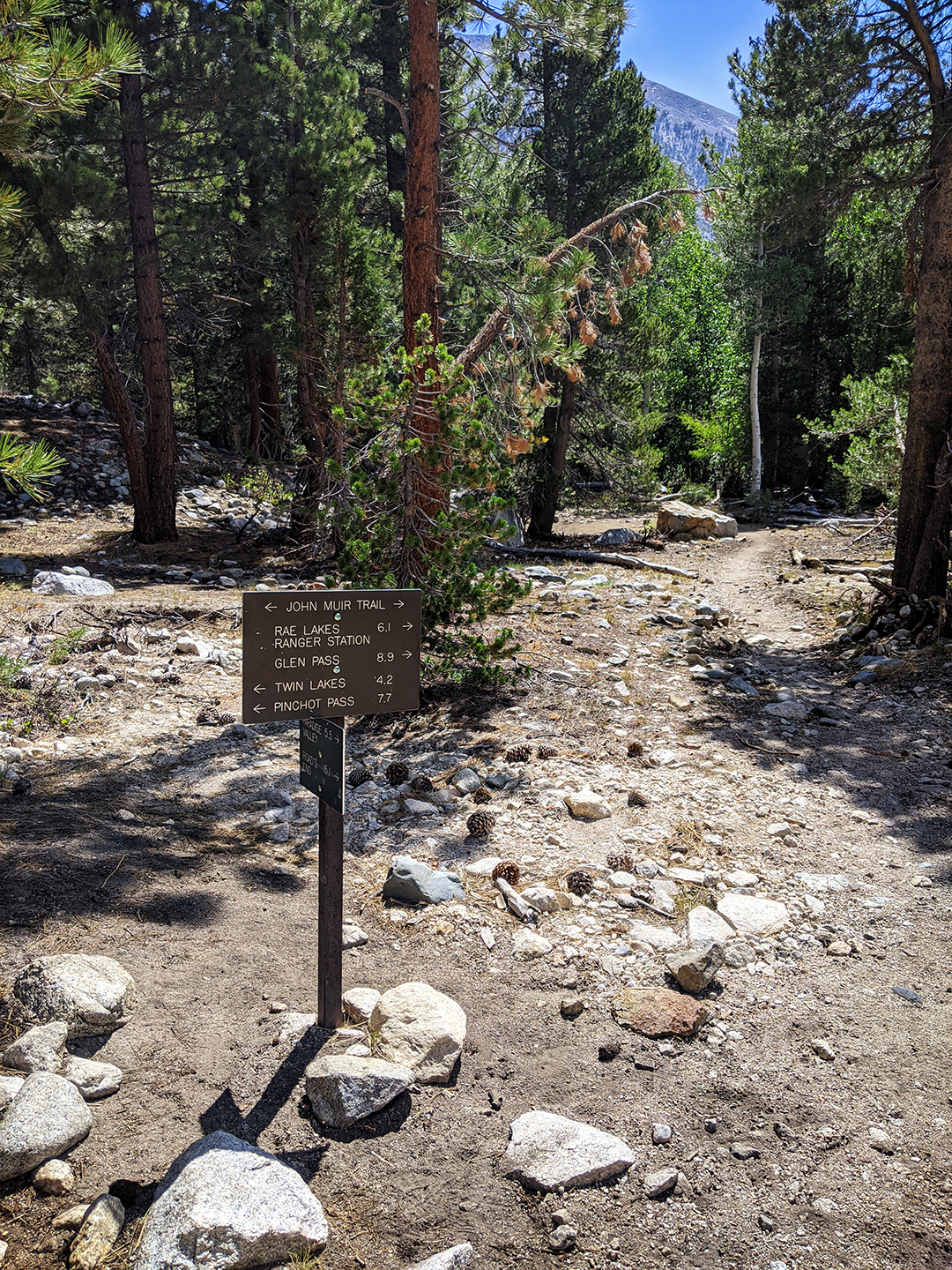
The bridge at the South Fork Crossing has been out for years, so right off the bat I needed to wade through the creek. Sometimes the current can make the crossing problematic, but water levels were low this season and I only got wet up to my calves. I dried off my feet, put my hiking boots back on, and followed Woods Creek for about five miles before reaching the junction with the John Muir Trail, which along this section also overlaps the Pacific Crest Trail.


At this point I began to realize that my stomach was unhappy. Something I ate or drank that morning was stirring up trouble. Nothing serious, but enough to sap my appetite and leave me feeling hollowed out.
On the other side of the Woods Creek Crossing I stopped for lunch and made myself eat a granola bar. The next four miles, all uphill, wore me down – every single step a grinding chore – but along with the higher altitude came increasingly beautiful scenery. Towering rock walls rose in every direction, mountain streams cascaded through steep valleys, gnarled pine trees sprung from tiny cracks between boulders. Black bears are common in the area but I didn’t manage to spot one.


I passed Dollar Lake and arrived at Arrowhead Lake, where I planned to camp. I set up my tent at a nice flat site and sat down on a rock to rest. It’s still pretty early, I thought, lots of light left. Rae Lakes is only a couple miles further. Why not keep going? I’d planned to make the short hike to Rae Lakes the next morning and spend the afternoon exploring the area, but why not move things up a day? And that way if my stomach took a turn for the worse I’d be that much closer to finishing the loop.
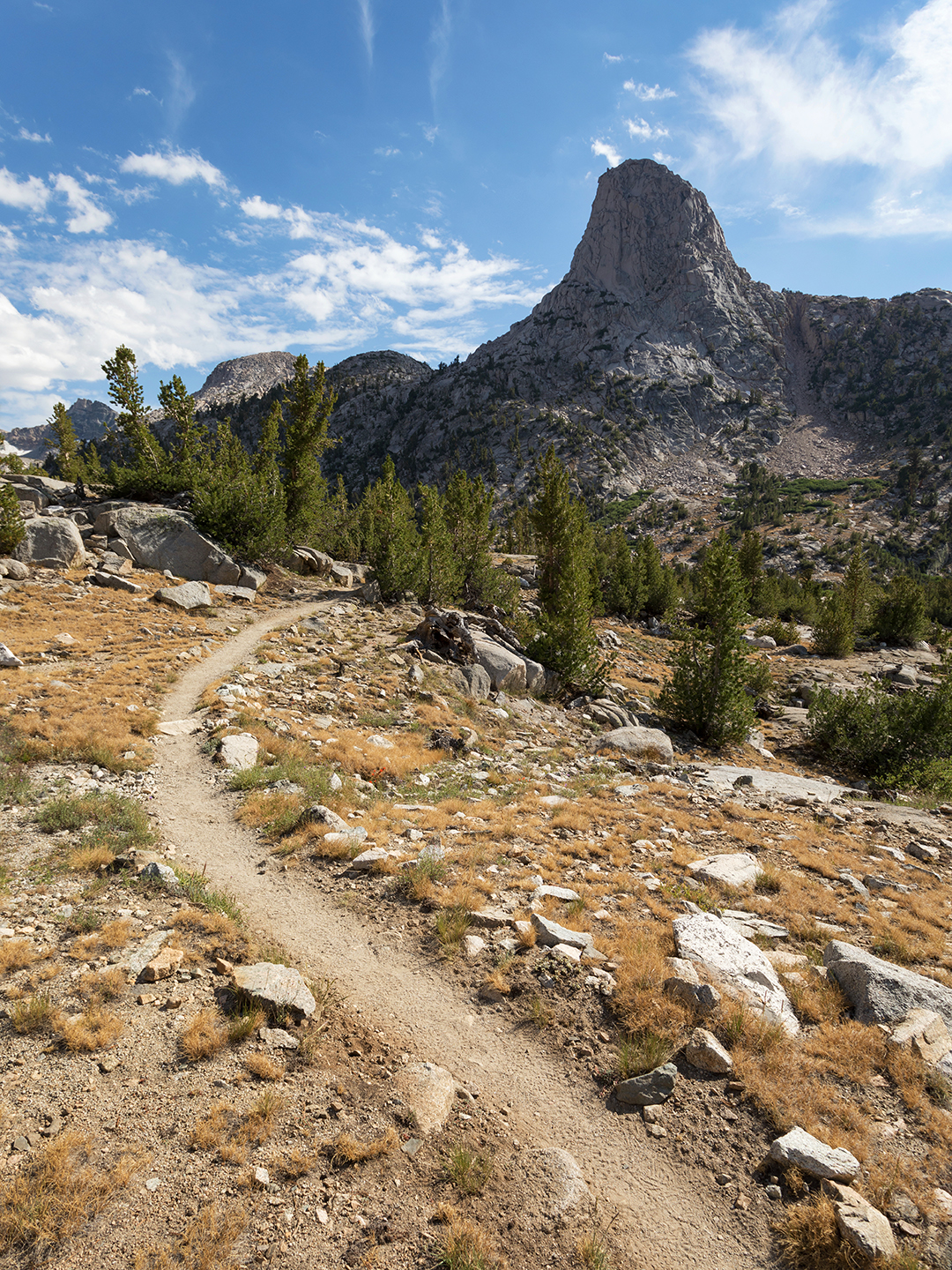
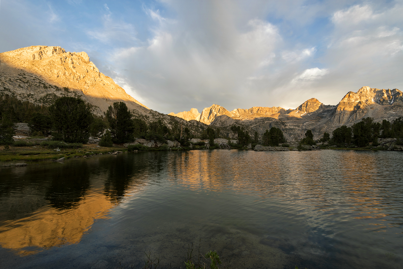
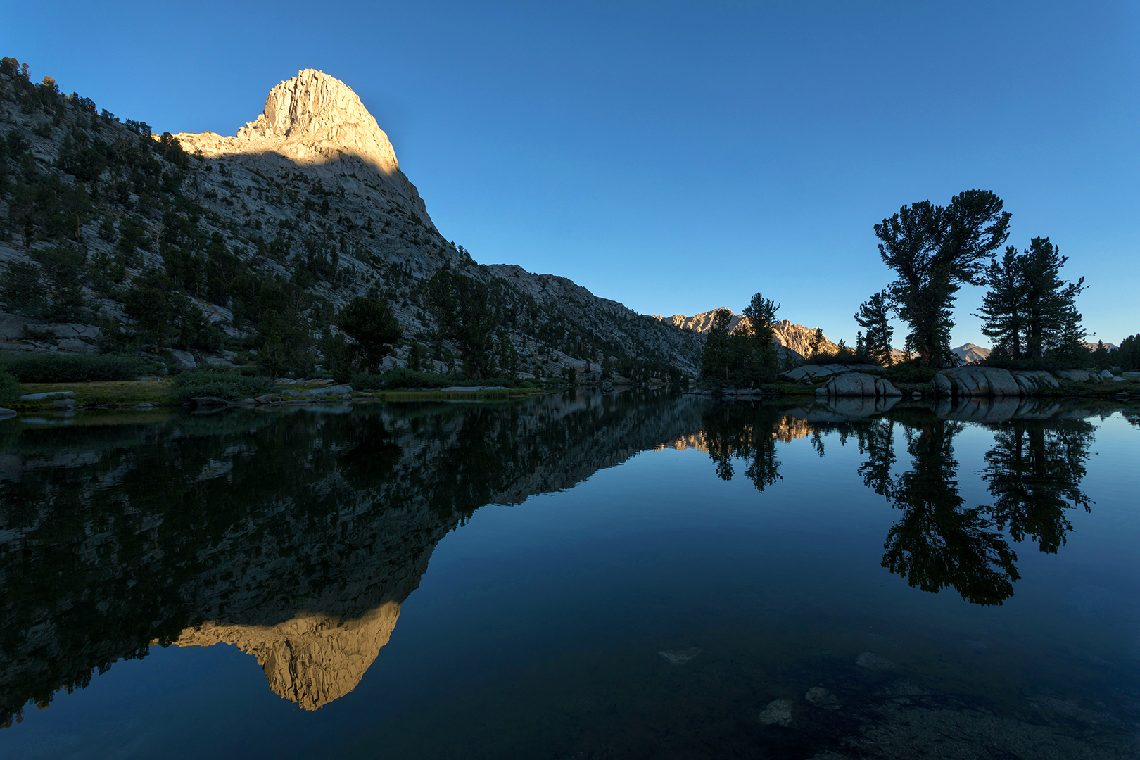
So I packed my tent back up and kept going. Before long the the distinctive granite silhoutte of Fin Dome appeared on the horizon and I reached Lower Rae Lake, a sliver of cold blue water offering a blurry reflection of the mountains rising on its western edge. Between Lower and Middle Rae Lakes I found a cozy campsite surrounded by car-sized boulders and re-pitched my tent.

As the sun dropped I sat at the lake’s edge and watched the fading light linger on the Painted Lady and the other massive peaks to the south and east. At sunset the clouds to the north and west above Fin Dome lit up with an ever-shifting kaleidoscope of warm colors, yellow and peach and coral, blanketing the entire landscape in its glow.

Day 3: Middle Rae Lake to Road’s End (21 miles, 1,900 ft elevation gain, 7,000 ft elevation loss)
I never sleep well in tents, but that night I slept as poorly as I ever have while camping. The altitude and my stomach apparently teamed up to make things disagreeable. So I was thrilled when a hint of light finally appeared the next morning, and by 7:15 I’d already packed up, forced down coffee and a brown sugar cinnamon Pop Tart, and photographed the first sunlight hitting the nearby mountains.


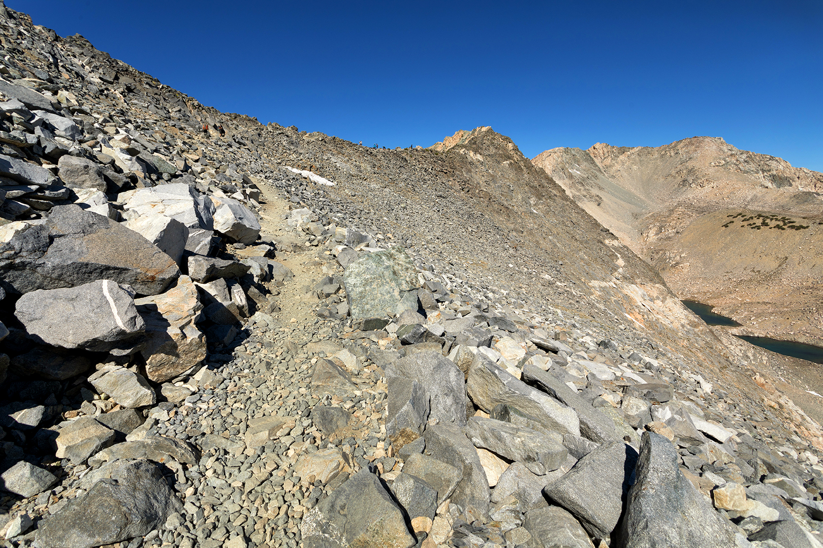
Glen Pass, at almost 12,000 feet the highest point of the loop, was just a couple miles ahead. My legs felt fine, but the steep climb was humbling. I had to constantly stop for short rests. Just above the tree line I thought I’d reached the pass and even stopped to mark the occasion with a rare self-portrait, but it turns out I still had another series of switchbacks ahead of me.

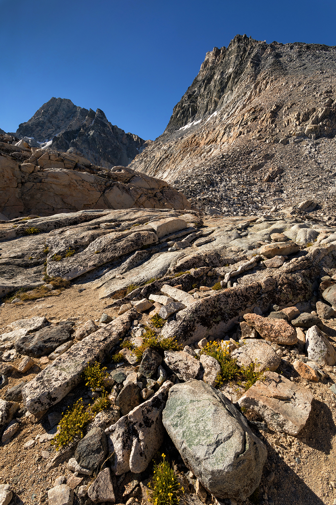
One step at a time, huffing and puffing, I finally dragged myself up to Glen Pass, where a handful of other hikers were taking in the view. To the north you could still see Rae Lakes, blue-green pools in a gray granite bowl. And to the south, visible to me now for the first time, a lone tranquil alpine lake ringed by steep cliffs.


From that point onwards my hike would be downhill. Hiking downhill with a heavy pack is no picnic, but for me it’s ten times easier than uphill, and as soon as I began walking down from Glen Pass my pace soared. Before I knew it I’d reached Vidette Meadows, where I’d planned to camp for the night. But it was only noon. Just 13 more miles to go, I thought, basically all downhill. Why not try to finish up today?
Some of the motivation was simply my deeply-rooted impatience with sitting around. Also I wanted a challenge, curious to know if at age 50 I was physically capable of hiking more than 20 miles in a day with a heavy pack and almost 9,000 feet of elevation change (about 2,000 up and 7,000 down). I wouldn’t have done it if I needed to continue hiking the following day, but if I finished the loop I’d have nothing to do but rest. So I decided to give it a shot.
Three miles later I reached Junction Meadow. Blisters were forming on both feet, but other than that I felt OK. I passed Charlotte Creek and Sphinx Junction, and after a stretch of steep switchbacks I arrived at the Paradise/Bubbs Junction, leaving just two relatively flat miles to go.

Knowing the end was near made every step tougher, and my legs and back were in full rebellion by the time I hobbled to the finish line. I made it to my car just after 5pm on Wednesday. I’d managed to finish the Rae Lakes Loop in three days, not too shabby for an old man! It’s the farthest I’ve ever traveled on foot in a day.
I did pay a price, but nothing extreme. My legs and back were sore for days, and it took almost a week for the blisters on my feet to heal. Thankfully my stomach recovered and never became a big problem.
I have mixed feelings about how I handled the trip. Part of me wishes I’d been patient enough to hike the loop slowly and appreciate having lots of down time in the midst of so much natural beauty. And another part of me is happy to have used the hike to test my physical limits and see how much I still have left in the tank. Regardless, in the middle of this pandemic I’m grateful to be able to take a trip of any kind, let alone one to such a special place.
