
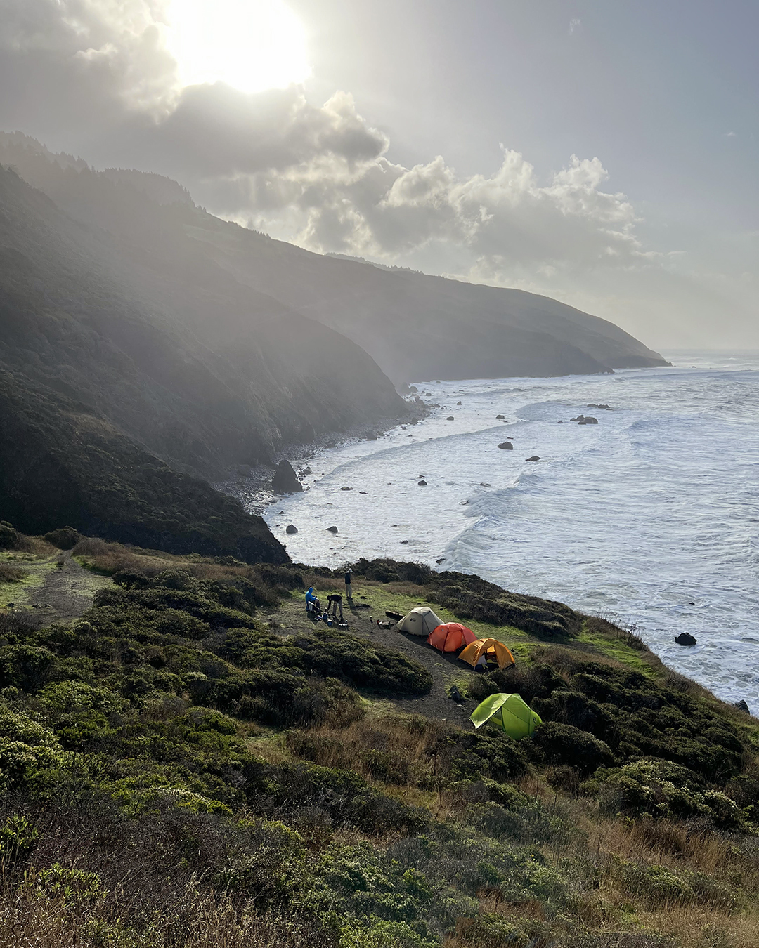
We set up our tents on a bluff overlooking the Pacific Ocean. A steep cliff – dotted with the silhouettes of Brandt’s cormorants peering from their nests – plunged down to a thin rocky strip of wave-washed beach. Just offshore a group of sea lions napped on a tiny stone islet just tall enough to protect them from the pounding surf. Above, the setting sun occasionally peeked through a layer of fog rolling in from the King Range mountains.
Finally! It took us years to get there.
Back in 2019 I hiked part of the Lost Coast with my friend Lawrence and his friend Jonas. Here’s how I described it then:
“The Lost Coast is a stretch of the northern California shoreline that’s so rugged there are very few roads. State Route 1, a highway that hugs almost the entire coast of California, cuts inland at the Lost Coast and bypasses the whole area, leaving it mostly undeveloped and empty. The trail we planned to follow starts at Black Sands Beach in the small town of Shelter Cove and runs 25 miles north through the King Range Wilderness to Mattole.”
Kevin, a friend since high school, read my blog post on the Lost Coast and “immediately added it to my bucket list,” he said. Kevin then recruited me and two other high school friends – David and Rob E. – to hike the Lost Coast with him in 2021. Unfortunately a problematic tide schedule and a bad wildfire season put the kibosh on our plan, so we explored southern Utah instead and had such a good time that we decided we should do a hiking trip every year. In 2022 we targeted the Lost Coast again but didn’t organize ourselves quickly enough to get the necessary permits, so we pivoted to Half Dome at Yosemite.
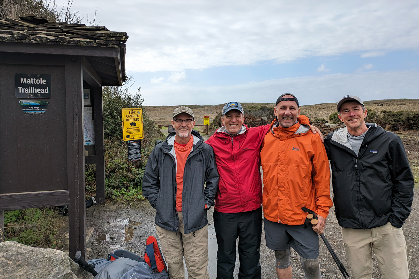
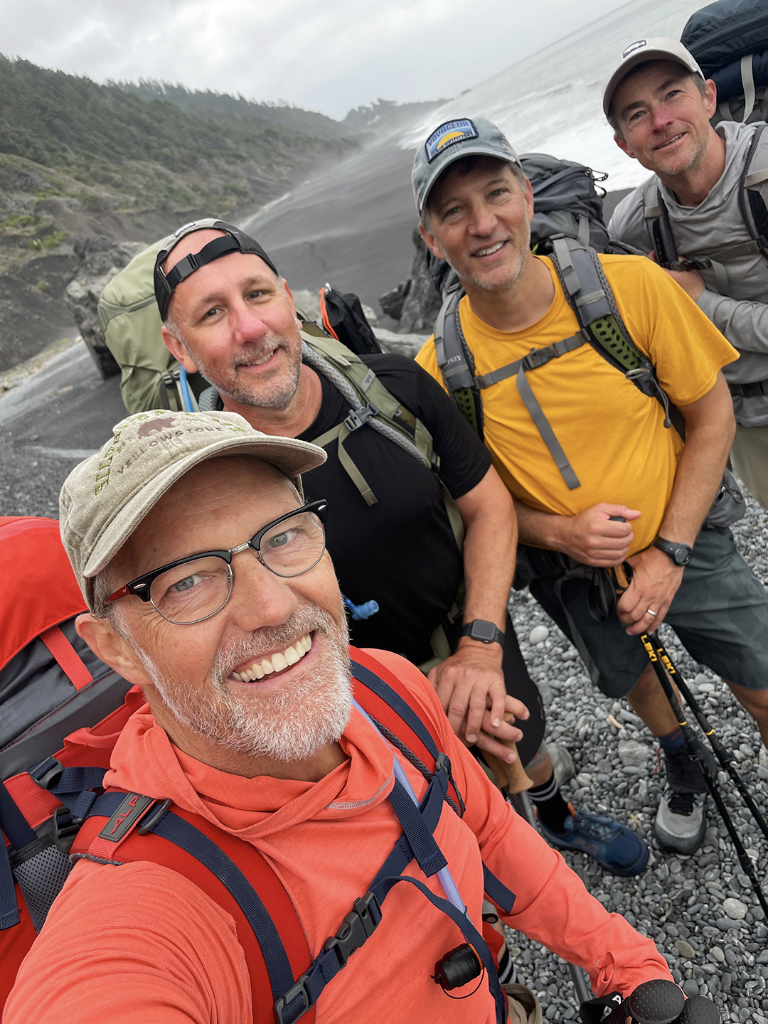
This year, happily, the stars aligned. We secured our Lost Coast permits well in advance, the wildfire risk was relatively low, and the tides – while not ideal – looked manageable. In early October I drove to Shelter Cove to meet Kevin, David, and Rob E., who all flew to Oakland and rented a car.

We had an extra day before starting our hike and decided to walk up the coast to the Horse Mountain Creek trail. A storm had blown in the night before and cold rain fell all day, sometimes heavily. On our way to the trail we noticed a dark shape in the water and realized there was a whale – likely a gray whale – just offshore.

The presence of poison oak around the Horse Mountain Creek trailhead was enough to turn David around, and I walked back with him while Kevin and Rob E., bravely undeterred, continued up to a viewpoint. Eventually my shoes were so waterlogged that they squished with each step. We crossed out fingers that the weather would improve overnight.
We woke the next morning to steady rain. Our plan was to tackle the Lost Coast from north to south, starting at Mattole and hiking back to Shelter Cove, and instead of leaving a car in Mattole we decided to take a one-way shuttle. “Most of the storm should be over by now,” our shuttle driver assured us as rain continued falling throughout the drive. And sure enough, the sky began to clear about 10 minutes before we reached Mattole – some very welcome luck to start our hike.
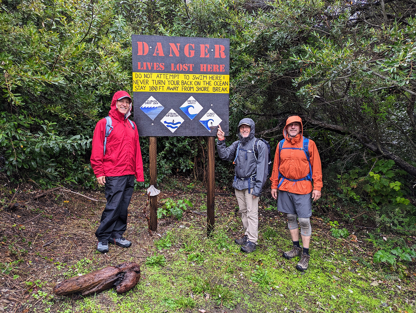
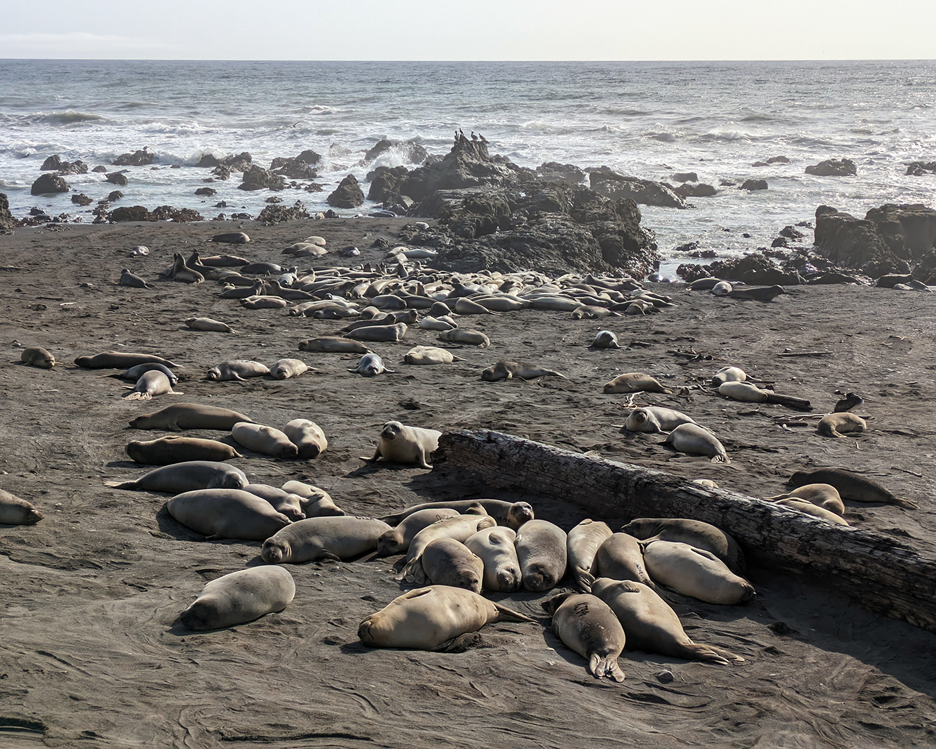
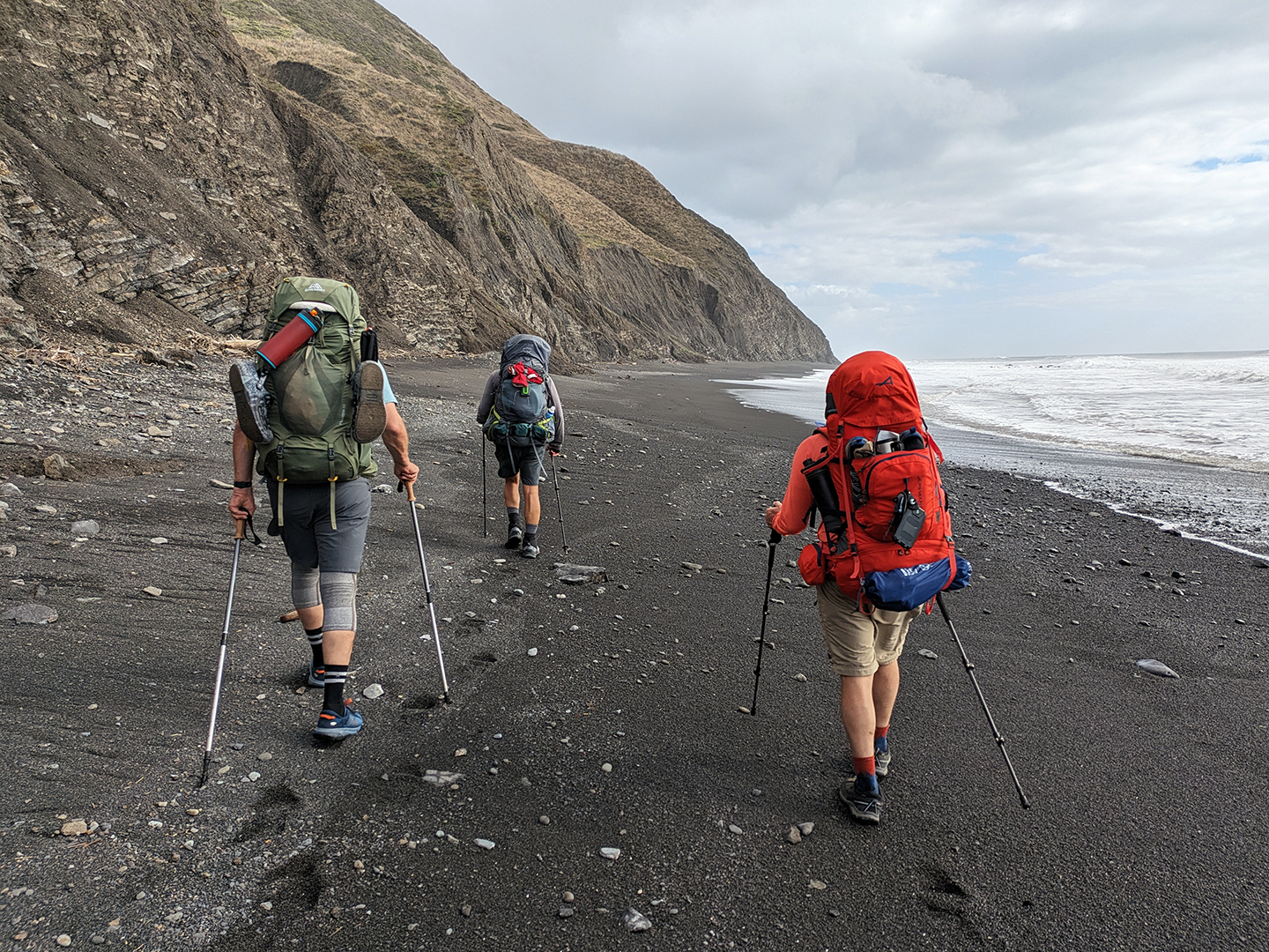
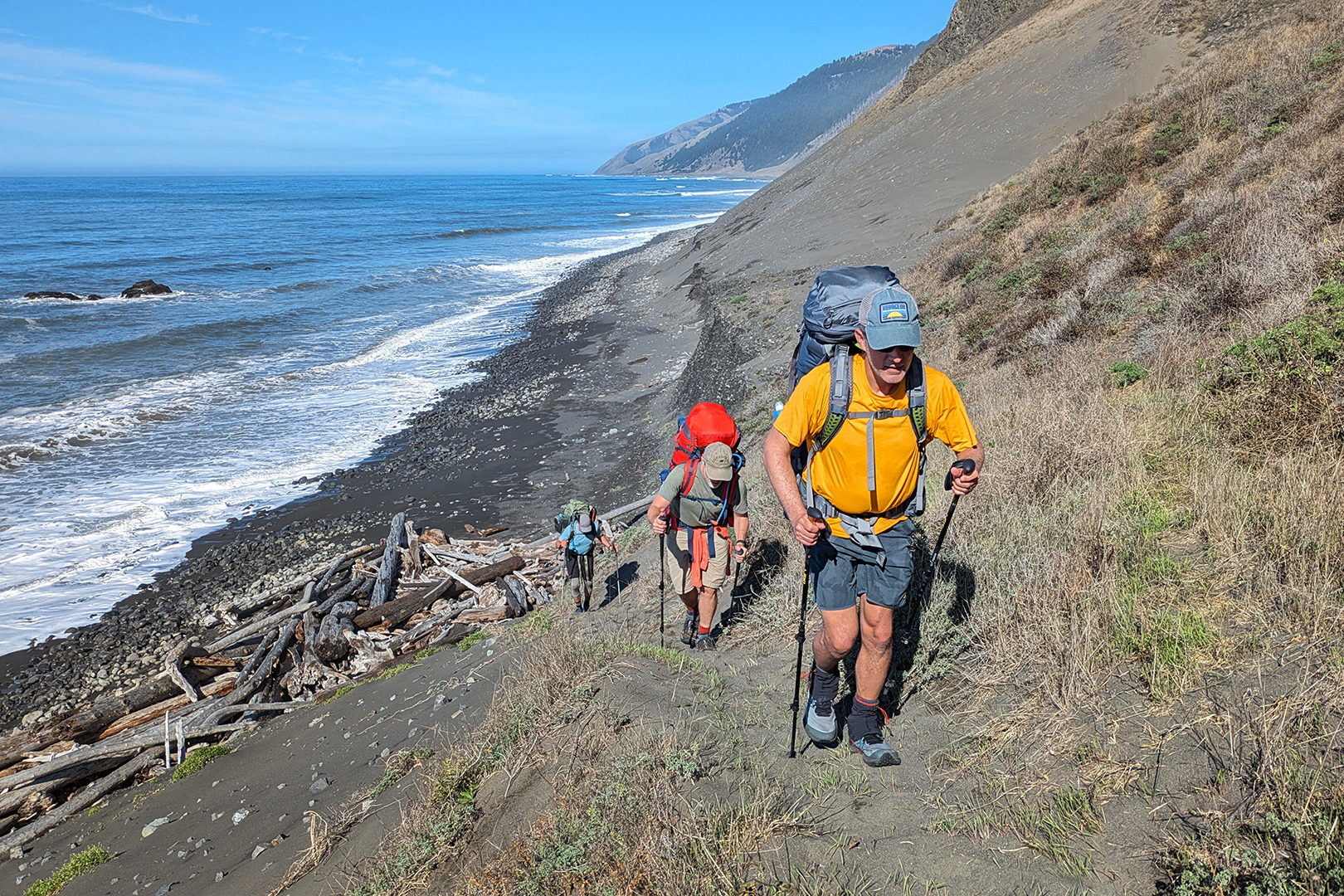
The Lost Coast includes two large “impassable” zones, each 4-5 miles long, where the trail runs along shoreline that can be pummeled by waves during high tide. To be safe we needed to cross those zones when the tide was lower than about three feet. We reached the initial impassable zone after hiking only four or five miles on our first day, with stops to check out the Punta Gorda Lighthouse and the nearby elephant seal colony. The tide wouldn’t cooperate until the next afternoon, so we camped at Sea Lion Gulch and settled in to enjoy the incredible views.


The next day we headed out in the early afternoon, crossed the first big impassable zone without any problems, and eventually covered about nine miles before setting up our tents at a windy campsite by Kinsey Creek.


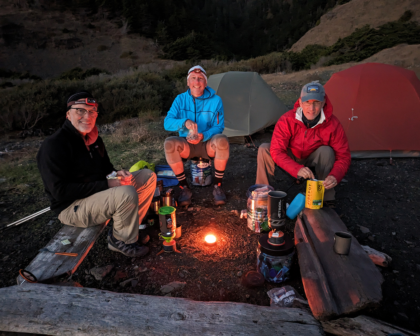
In some ways it was ridiculous that we each brought our own tent instead of sharing, but there were clear benefits. David, for example, was traveling with an extensive collection of lotions, creams, ointments, salves, balms, poultices, and unguents – much like a 19th century apothecary – to treat a perplexing variety of skin conditions (including, of course, potential exposure to poison oak), and each of us having our own space meant that nobody else was forced to witness his alarmingly frequent application rituals. I found myself wondering if David’s Google search history included the phrase “highest-rated mortar and pestle.”
Around noon the next day we reached Big Flat, where a few surfers were catching waves just offshore. “I’ve been all over,” one of the surfers told us as he watched his friends, “and this is my favorite place in the entire world.”
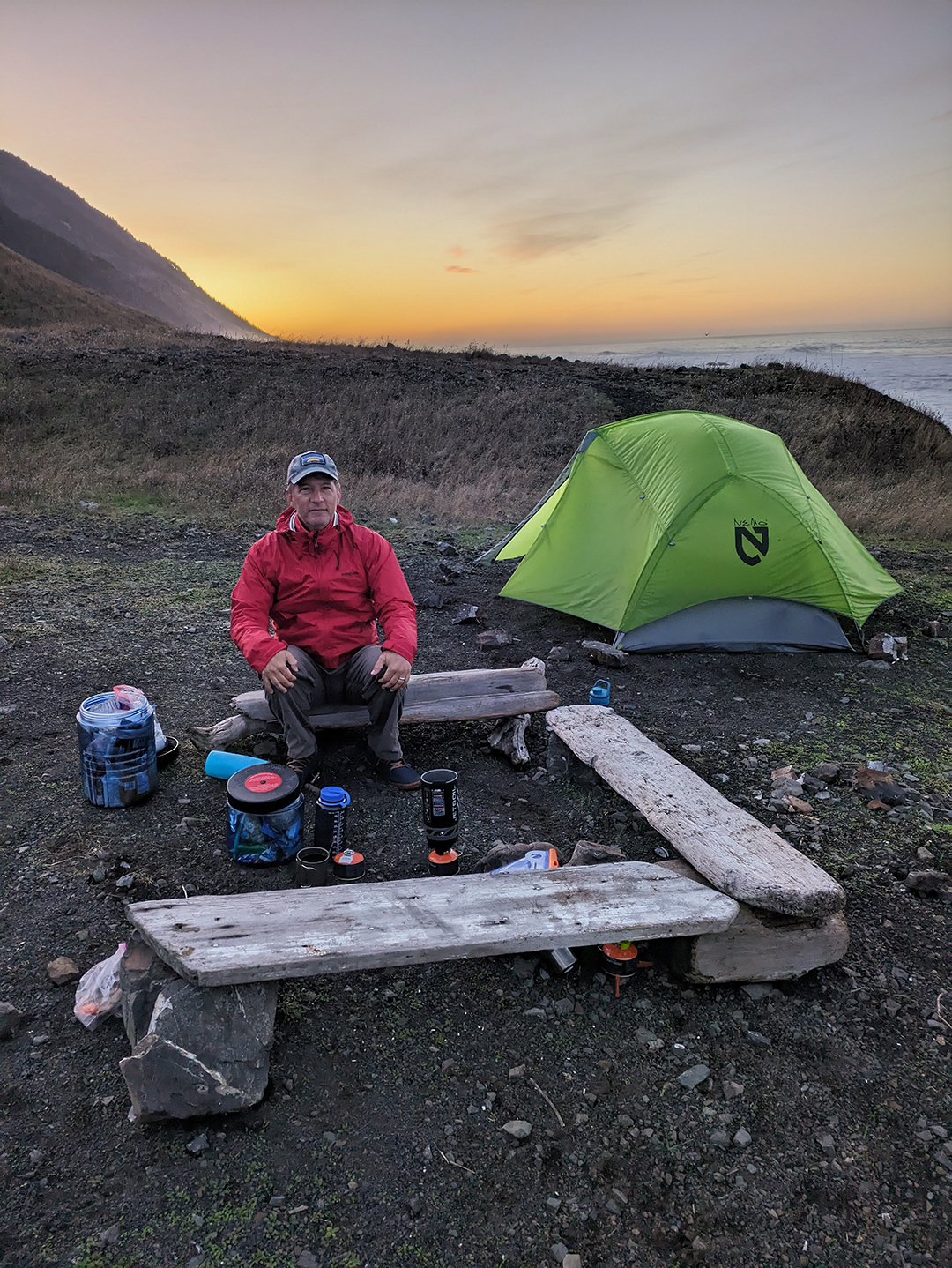
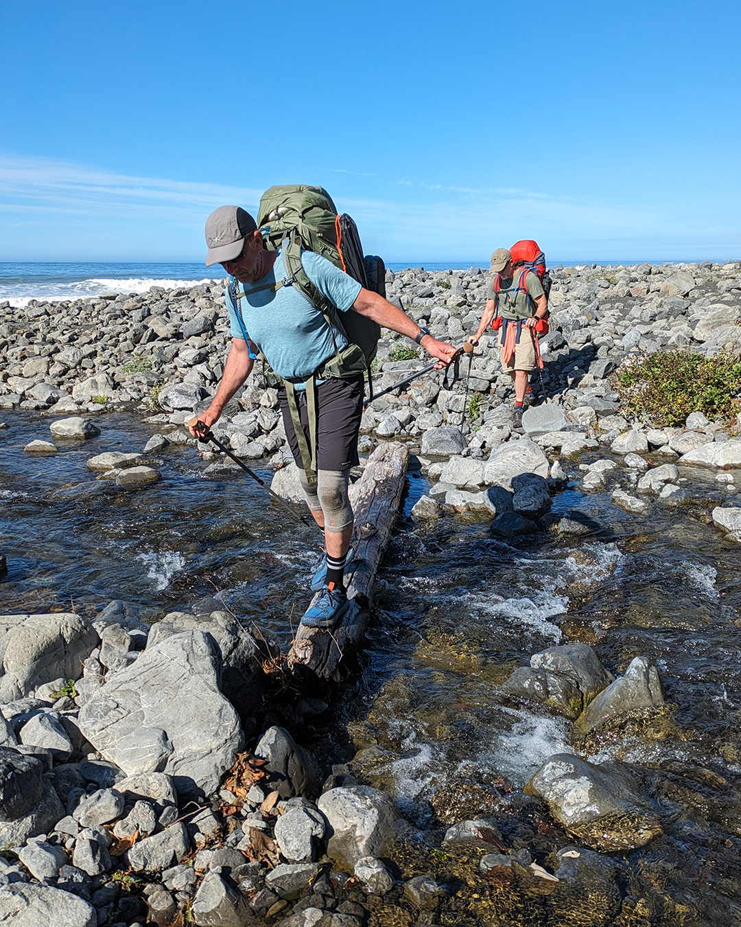
As we crossed the second and final impassable zone, the tide – receding but still feisty – sometimes forced us to dart inland to avoid particularly large waves. At Gitchell Creek, just beyond the impassable zone, we set up our tents in the sand behind a large driftwood tree trunk and ate our rehydrated dinners as the sun set.


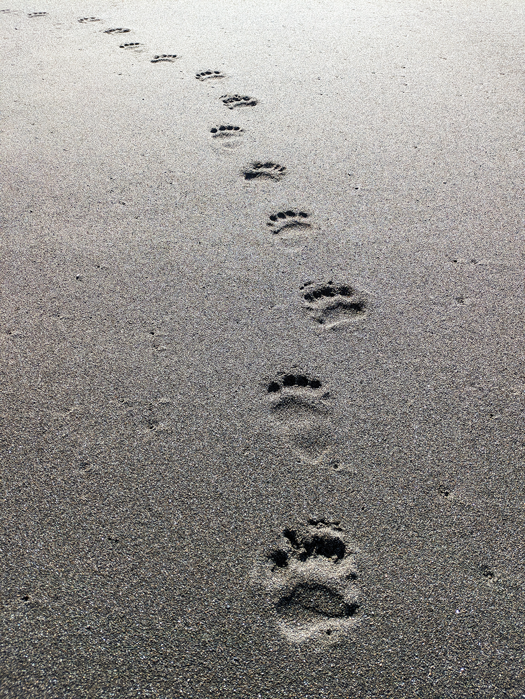
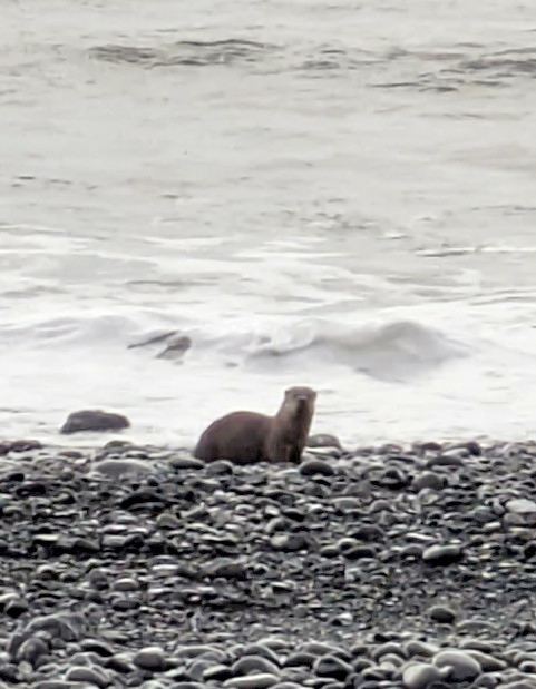
“Hey, look over there!” I suddenly stammered, so excited I could hardly get the words out. An otter! And not a sea otter (which wouldn’t have been that surprising), but a river otter running up from the surf alongside Gitchell Creek. I’d chosen not to bring my big camera on the hike, wary of the extra weight, and now I was really kicking myself for lacking the right gear to capture such an unexpected photo opportunity.
I didn’t even manage to get a phone photo of the otter that evening, but thankfully our new friend (like its often-crepuscular cousins in Yellowstone) was active early the next morning as well. We watched it swim into the surf and spend about a half hour diving for what must have been mussels, clams, or some other little bits of food on the ocean floor. Until that point I hadn’t even realized that river otters will sometimes hunt in salt water.

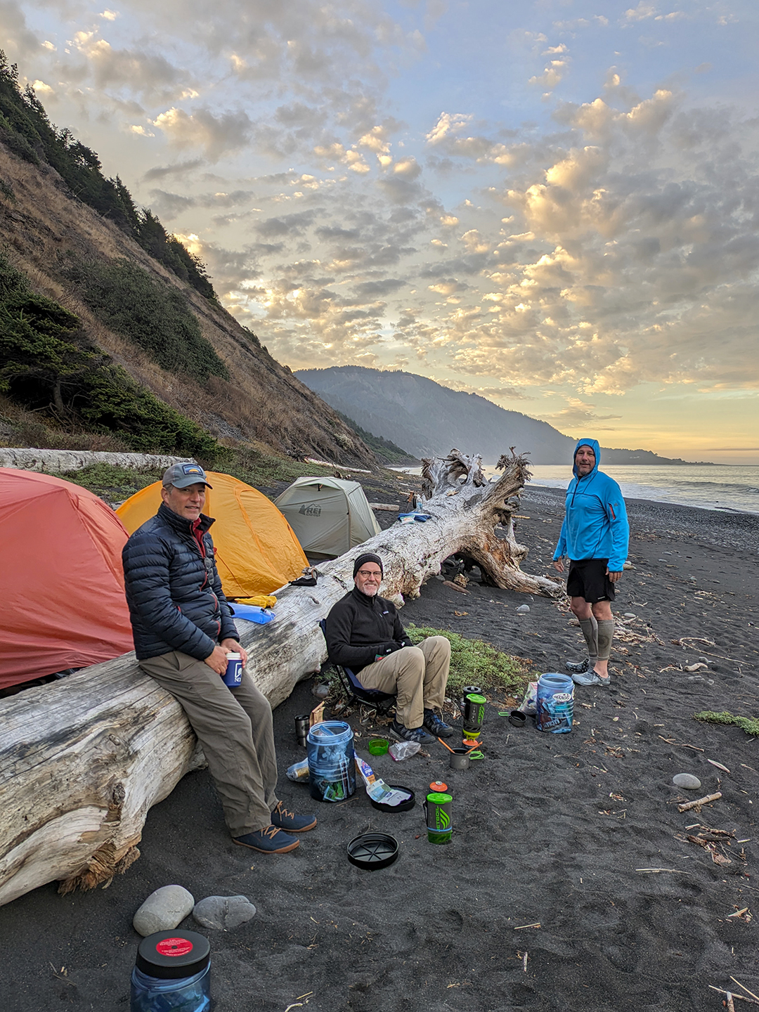
We packed up our tents after a quick round of Frisbee on the beach and then headed south for the final stretch. Four relatively easy miles later we reached Shelter Cove and completed our hike. A light drizzle began falling as soon as we got back to our cars, bookending our hike with rain and emphasizing how fortunate we’d been with the weather.
That night we stayed at an Airbnb in a rural area near Myer’s Flat. Rows of cultivated marijuana plants surrounded the house, and the interior decor gave the strong impression of someone who regularly partook of the homegrown harvest. David and Rob E. slept on the living room couch because they were (quite justifiably) creeped out by the “Silence of the Lambs” vibes radiating from the downstairs bedroom.
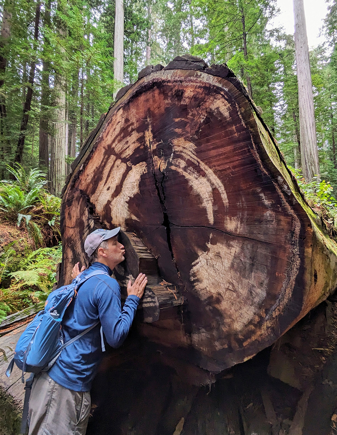
The next day we hiked the Bull Creek Flats trail at Humboldt Redwoods State Park, where David’s enthusiasm for gigantic old-growth trees bordered on the uncomfortable.


We spent our final night in Novato and I woke up before dawn the next morning for my drive back to Montana. The rest of the group hiked to the top of Mt. Tamalpais before catching their flights home. It was awesome, as always, to hang out with David, Rob E., and Kevin, whose friendship I’m even more grateful for with each passing year. We were all happy that the trip went so smoothly and that we finally made it to the Lost Coast. Well worth the wait!

Rob- Thanks so much for chronicling this trip so eloquently in text and photo. Beautiful pictures and fun narrative. This brings a lot more appreciation of the level of difficulty, especially of those long bolder treks the the other Rob noted were really challenging. We had watched the Hiking Guy (?) video before you guys set out. He tended to be dismissive about the challenges. I’m really glad you guys have bonded over these trips. That’s priceless brotherhood. Keep it going so long as you can walk (and David keeps you all healthy).
LikeLiked by 1 person
Thanks! Putting these posts together is entirely my pleasure. Given that I tend to forget so much so fast, I really appreciate having a way to make sure I can go back and relive these experiences… We’ll definitely keep doing these trips as long as we can!
LikeLike