I fell asleep in the seemingly endless suburban sprawl of Buenos Aires and woke to the barren, desaturated pre-dawn of Patagonia. Patagonia! Was I really here?
With Patagonia it’s not entirely clear where “here” is. In his introduction to the Bruce Chatwin classic In Patagonia, Nicholas Shakespeare explains the area’s geographical ambiguity: “Patagonia is not a precise region on the map. It is a vast, vague territory that encompasses 900,000 square kilometers of Argentina and Chile. The area is most effectively defined by its soil. You know you are in Patagonia when you see rodados patagonicos, the basalt pebbles left behind by glaciers, and jarilla, the low bush that is its dominant flora.”
Everyone else on my bus was still sleeping. Purple drapes blocked almost all signs of the outside world, but a few rows back, on the left, the one window through which the angle made it possible for me to witness the day’s first light had by chance been left uncovered. Sunrise in Patagonia… I really am here.
Most people say Patagonia begins south of Rio Colorado, which my bus crossed sometime in the still-dark morning. We’d left at 8pm the night before and drove for 22 hours before arriving in San Carlos de Bariloche. It was the longest bus ride I’d ever taken.
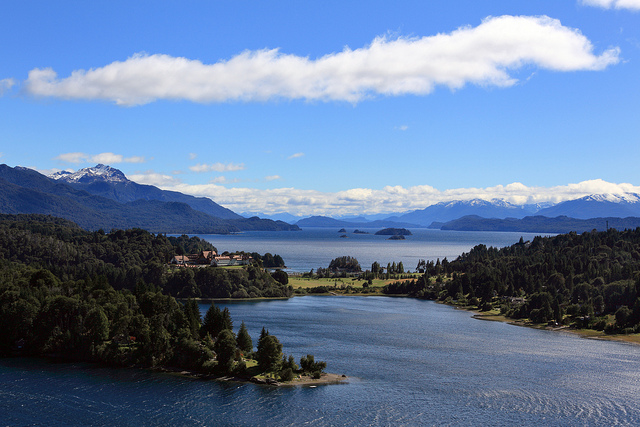
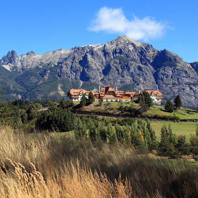
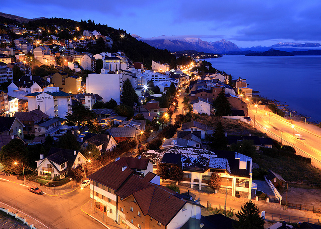
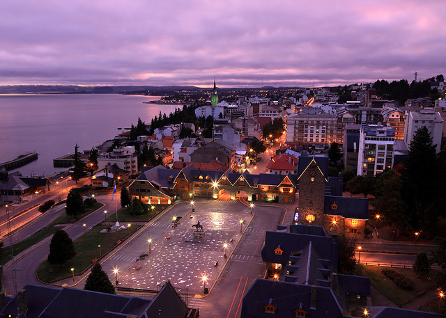
Bariloche, a resort town, may be the least Patagonian place in Patagonia. It’s set on the shore of a large mountain lake, not unlike Tahoe in California, with hiking and mountain biking in the summer and skiing and snowboarding in the winter. In a region that has one of the lowest population densities on earth, Bariloche is an anomaly – a busy mid-sized city with a large permanent population.
Before leaving Buenos Aires I’d been instructed to prepare myself for Patagonia’s extraordinary weather and relentless wind. “You can be enjoying a warm sunny day, and then 10 minutes later you’re in the middle of a blizzard,” I was told. “You never know what you’re going to get.”
My weather experience in Patagonia would be further colored by the fact that it was late to be heading south. Most tourists visit Patagonia in the southern hemisphere’s summer, roughly January through March. I was barely catching the tail end of the season. Much of the tourist infrastructure would be shutting down and temperatures would be dropping.
So it wasn’t a big surprise when my first two days in Bariloche were windy, cold and wet. Walking along the streets I sometimes had to incline my body 20 degrees into the wind just to avoid being blown over. But on my third day the wind temporarily abated, the sun finally appeared, and the temperature rose dramatically. Determined to take full advantage of any interval of not-awful weather, I rented a mountain bike and rode the Circuito Chico, an easy 27-kilometer loop through the Llao Llao peninsula in Nahuel Huapi National Park, just north of town.


A little later that morning, on what locals said was the sunniest day in two weeks, I joined 14 other tourists for a trip to Tronador, a glacier-covered mountain perched on top of the continental divide. In Patagonia the continental divide is usually used as Argentina’s border with Chile, so Tronador had the distinction of dual citizenship.
The three-hour drive from Bariloche to Tronador passed through beautiful mountain scenery, and my heart ached each time we sped by a spectacular photo opportunity without pulling over. If we weren’t on a tight schedule I would have thrown a temper tantrum until the driver hit the brakes.
Our first stop was at Ventisquero Negro, a spot where one of Tronador’s glaciers empties into a lagoon. We’d only been there a few minutes when we heard a deep rumbling sound, exactly like thunder. “Tronador means Thunderer,” our guide had explained earlier. “The name comes from the sound avalanches make.” Sure enough, I looked up and saw a river of ice and snow rolling down the mountain.


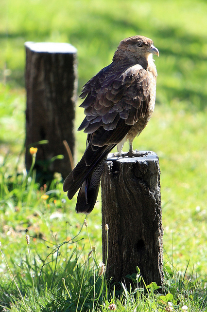
Most of my fellow tourists were American, something that had never happened on any of my tours in Asia or Africa. Three of the guys looked and talked like they were auditioning for MTV’s Jersey Shore. When our guide mentioned that we might see condors, one of Jersey Shore Three snickered and yelled, “Condoms! Dude, did you say we might see condoms?” His two buddies laughed loudly, and for a second I thought there might be a round of high-fives.
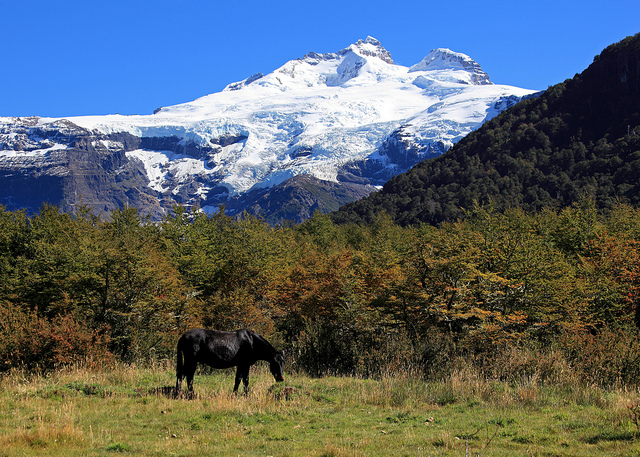
We stopped at a lodge near the trailhead to the Castaño Overa glacier. Friendly horses grazed in a nearby field, framed underneath the white pyramid of Tronador’s summit. The scene was so idyllic it felt unreal.


From the lodge we began the four-hour hike to Castaño Overa. As we walked one of the Jersey Shore guys asked me where I grew up. “Kansas City,” I said.
“Kansas City!” shouted an energetic American woman who hadn’t spoken a word to me before that point. “No way! I live in Indiana!”
No way! One of us, like, lives in the general geographic region where someone else grew up? OMG! Like, what are the odds? Given that there are about 10 Americans on this tour and we all have to come from somewhere, I’m guessing the odds are only, like, 75%! I can’t believe it!
Yikes. Alerted to my perilously anti-social level of undercaffeination, I managed to respond with something along the lines of, “Indiana, huh? That’s great!”
I tried to find space away from the group, but the booming voices of the swaggering Jersey Shore Three were difficult to escape. I heard one ask, “Dude, when you were young, did you ever, like, smash fireflies and rub the glow-in-the-dark stuff underneath your eyes? You know, like eye black for football, except the opposite?”
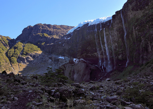
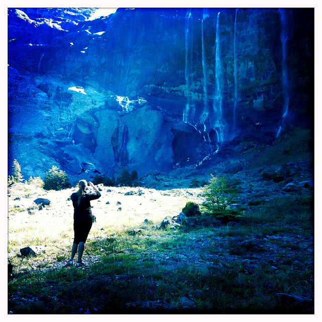
Not having heard much about Castaño Overa, I wasn’t expecting anything special. So the first sight of it literally stopped me in my tracks. The glacier ends at the top of a sheer cliff, where it calves into open space. Snowmelt sends several small waterfalls plunging down the almost-vertical rock wall below the glacier. I’d never seen anything like it.